The Tidal Road Southpool to Mill Bay
- Gethin Thomas

- Jan 22
- 4 min read
This drive was taken in January 2025, on my previous attempt the road was shut half way along so I only reached Goodshelter here.

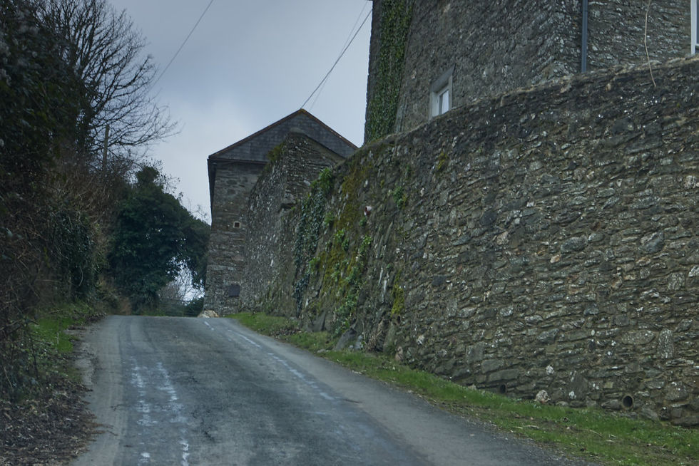
I am starting the photos on the hill above Frogmore and Southpool Creeks. In January the hedges have usually been trimmed and although grey and stark it all looks very neat and tidy and typically Devon in appearance. Typically South Hams in fact. This view is looking south to Prawle Point. This is the road to Southpool.

It is definitely unsuitable for heavy goods vehicles, as we'll soon see. You will also need tide tables as the title of this post suggests. Parts of this route can be a metre or more under water at times.

Sign posts around here will direct you to places that Google maps has not reached or recognised. Turn here to Scoble or Halwell and you may be disappointed unless you live there. They are not villages or even hamlets. Often it can just be a house or a farm, loosely described as a place.

Descending the hill into Southpool, the ancient tower of Southpool church comes into view. It sits above the village offering some protection to people hundreds of years ago from seaborne raiders who may have ventured up the creek looking for easy pickings. I have covered the church in some detail in a previous post here.

You'll find plenty of information on this pretty village with its idyllic setting and popular pub that attracts many customers and visitors, even some coming by boat at high tide from places such as Salcombe. We'll see Salcombe at the end of the road.

Rural England now has more defibrillators than telephones. I don't know how often they are used. The old red telephone boxes are still an essential element of the countryside though.

Here is the top of the creek, the boats don't come this far, there is a pontoon some way along that road opposite. You can drive through the water if you want the experience but there is a small stone bridge on the right.

Now we leave Southpool behind and head into the real wild country. Southpool counts as urban around here, and this road is now as narrow as they get.

There are farms and cottages scattered along the route and some groups of cottages even dare to have a name, like Goodshelter.

That's Goodshelter down there with its own miniature creek arm.


Descending again into Goodshelter there is a micro road that leads to Holset. Don't forget the road was unsuitable before we even got here, so how unsuitable is this? Google Holset and you find a house, but you can rent it for holidays if you dare.

Here is Goodshelter and we're in luck because I can just about drive through that.

Even the footpath is tidal.


Here's the tidal creek again but this time it doesn't have a name at all.


This is Little Haven which is on the map but it's just a gap between a fence and a cottage.

This is the biggest junction on the tidal road. On the left here is what you would loosely call the main road, the one you would sensibly take to this point. As you can see though, this is the point of no return, or rather the point beyond which you have to return. From this point the road is a dead end at Mill Bay. Every sort of warning says don't do it.

Even though this road really only serves a handful of millionaire mansions and the beach at Mill Bay it is also the gateway to Salcombe via the foot ferry.

This is a panorama of Salcombe the other side of the Kingsbridge Estuary or more accurately the Ria. If you have a large screen you can click on the photo for a more detailed view.

Here there is a glitch in the matrix or a kink in the road. One of those earlier warnings did say the road was weak and here is the proof. There is a vertical drop down to the beach right here.

So far you have seen the photos in the order I took them but a sleight of hand here on in is needed because from here I drove straight to Mill Bay and walked back. So I will now reverse the order of the photos so that you get a continued view of the route going in the right direction.


I have a previous series of Salcombe posts which you can see here.

I really like this old faded sign next to the ferry which tells its own story. One of the proscribed activities is "No radios and tape players", while the positively Victorian "No Hawkers or Pedlars" is still valid. There are also "No Discos or drinking competitions". When I see such specifics on a sign I also imagine what caused someone to include it, so I am now just conjuring up Glastonbury on sea at some point in 1974.

The Salcombe lifeboat is out on manoeuvres.


What millionaire's mansion is complete without your own footbridge to your private beach, free of pedlars and hawkers, tape players, discos and drinking competitions.

Remember that these photos were taken in the depths of winter, so as you can see we have quite a micro climate here to go with the micro roads. Micro Roads by the way is a term I have adopted, which was coined by an American friend, Bill from Texas. He has a British wife, and if they ever come down to visit the area he hands the car over to her once they reach Totnes. He refuses to drive any further. In Texas this would have 14 lanes at least, and probably the occasional Drive-Thru something or other.


Eventually, here we are at Mill Bay where you now have to drive over the sand to the car park.


This is one of the most popular beaches in the area because of it's fine sand. Many of the beaches facing the open sea are shingle.


From this car park there is the start of a beautiful section of the South West Coast Path to Gara Rock. I have a separate post showing that walk here. This is the end of the tidal road to Mill Bay.


Comments